Back to Nano Banana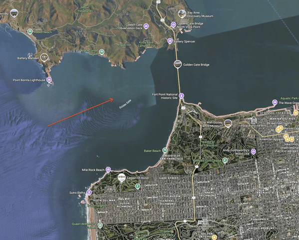
CASE 2
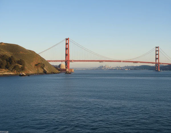
Generate Ground View from Map Arrow
Generate real-world ground-level views from Google Maps images containing red arrows, showing what the arrow sees from the red circle in the direction indicated.
Map View
Ground View
Upload Map Image
Upload a Google Maps image with red arrow
Make sure the red arrow and circle are clearly visible
Complete AI Prompt
draw what the red arrow sees
Generated Ground View
Your generated ground view will appear here
Upload a map with arrow and customize the view parameters
Map to Reality Tips
- • Ensure the red arrow and circle are clearly visible on the map
- • Higher resolution map images provide better location accuracy
- • Weather conditions significantly affect the atmosphere
- • Different viewpoints create unique perspectives of the same location